It’s been a damp to soggy day across southern New England. More rain is in the forecast tomorrow. We’ll clear out with improvements by the end of Friday.
A frontal boundary has been draped to our south today. An area of of low pressure will ride it tomorrow and a warm front lifts through. That will bring us more rain and breezy conditions.
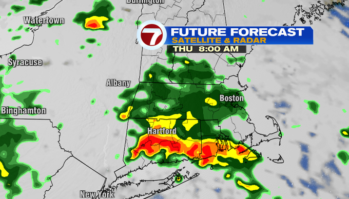
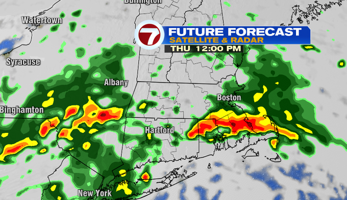
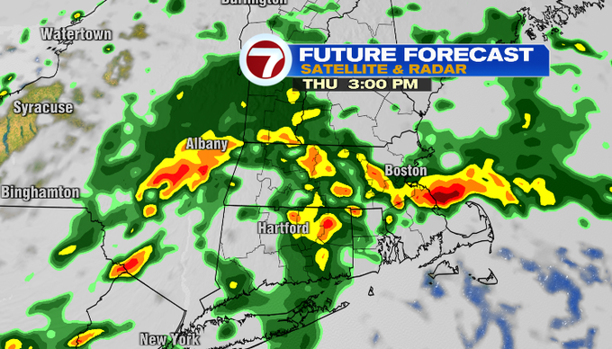
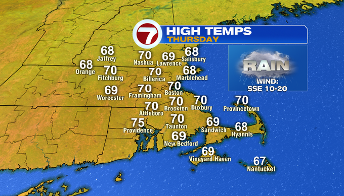
Overnight, there will be a few showers and areas of fog. It will be mild and muggy with temperatures only falling back into the upper 60s. Below you can see what radar could look like at times throughout the day tomorrow. At any point, we could expect rain in parts of our area. Downpours and thunder can be expected.


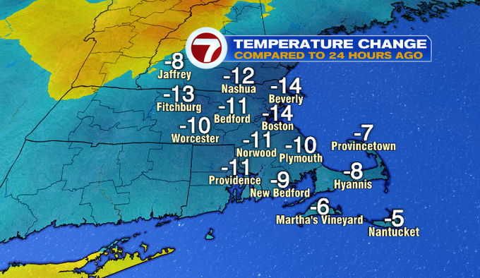
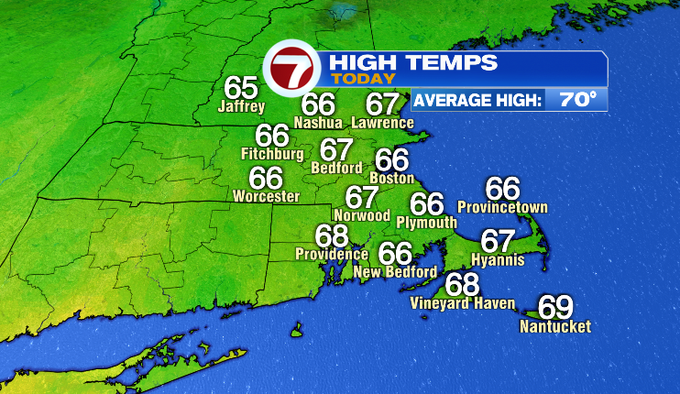
It was much cooler today than yesterday as we traded near 80° for highs in the upper 60s! That is actually closer to average than where we were yesterday. While tomorrow’s temperatures might be a couple degrees higher, it will feel a lot like today. We will be near 70° under a lot of clouds, and it will feel muggy.
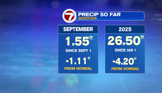
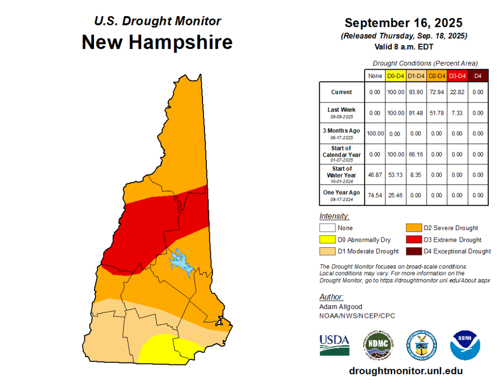
This bout of rain is much needed for southern New England. We’re below normal from the start of the month and year (numbers below don’t take into account today’s rainfall just yet). We’ll get an updated look at the drought monitor when it’s released tomorrow morning. Although, it won’t take into account rainfall since yesterday just yet. We’ll see what role that plays with the dry conditions next week. As of last week, 67% of Massachusetts is abnormally dry and 16% is in moderate drought. The bigger takeaway is that extreme drought set in for more parts of Northern New England. Nearly a quarter, about twenty-three percent, of New Hampshire is in extreme drought.

Meanwhile, the Atlantic Basin is busy! As of 2 pm Wednesday, Hurricane Gabrielle is a category two storm racing east at 26 mph. It is still about 1,100 miles west of the Azores. Gabrielle is expected to pass near or over the island chain late Thursday or early Friday. A Hurricane Warning is in effect for all of the…