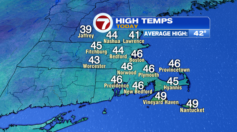
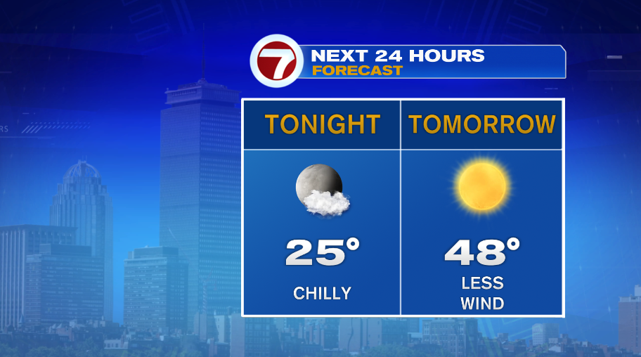
Finally we had a “mild” December day out there today! Temperatures ended a few degrees above normal (average high is 42°), but if you spent time outside you know that wind made it feel a bit cooler. Feels like temperatures today were generally in the 30s and near 40°. Not bad, but it could be better. Tomorrow will be better. Temperatures will climb to the upper 40s with tons of sunshine and less wind than today.
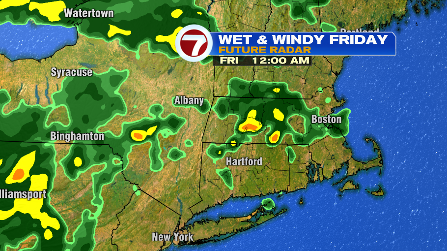
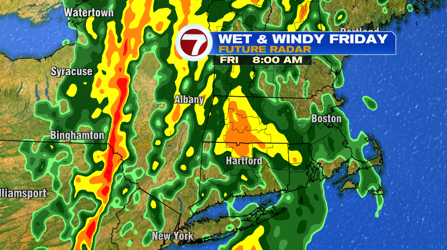
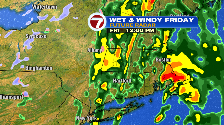
Friday some big changes are on the way. Friday is actually a pretty warm day, with temperatures reaching the upper 50s. The problem is, it’s not a nice 50°, we’ll deal with a soaking rain, embedded downpours and a howling wind. Here’s the timeline:
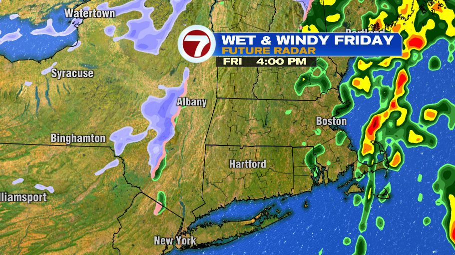
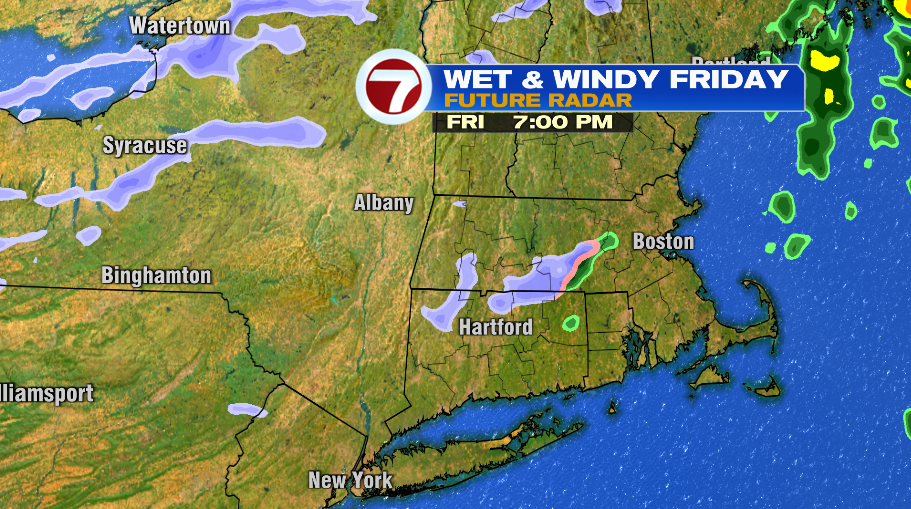
A few scattered showers will start to move in around midnight Thursday night going into Friday morning. The steadier and heavier rain will basically be a daylight storm — starting around or shortly after sunrise and continuing to just before sunset. During the day we’ll not only have rain, but embedded downpours as well. The rain will clear just before sunset, like 3 or 4pm, with maybe an isolated rain or snow shower hanging around through the evening.
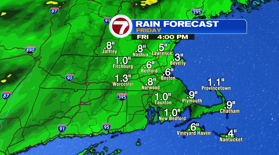
Between the rain and mild temperatures the next two days, we’ll basically torch any remaining snow that’s on the ground right now. Rainfall amounts Friday will generally be 1/2″ to 1″.
Then there’s also the wind. The wind will be howling with the rain, especially Friday morning. We have a wind advisory in effect for most of the area for wind gusts up to 50 mph. The higher terrain of Worcester county could even see a few isolated gusts to 55 mph. The Cape and Islands are currently under a high wind watch where the gusts over 50 mph to 55 mph are more likely and more frequent. The high wind watch is essentially a place holder for now, tomorrow that watch will either become a wind advisory like the rest of Massachusetts or could even be upgraded to a high wind warning. But it’s really just semantics, it’s going to be very…