Many of us are going to get our first plowable snow of the season this week in Massachusetts! However, for many others this storm will bring just plain rain.
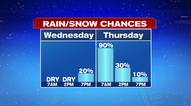
For tonight into Wednesday morning, it will be another frigid one. Low temperatures will drop to the upper teens and low 20s with a few clouds around. Wednesday will be bright to start the day, but you’ll notice the clouds increasing as the day goes on ahead of the storm. Highs will be more mild in the upper 30s and low 40s. Most of the rain and snow holds off until closer to bedtime Wednesday night.
The National Weather Service issued a Weather Winter Weather advisory starting at 8 p.m. that night.
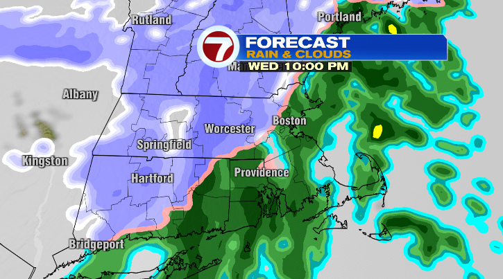
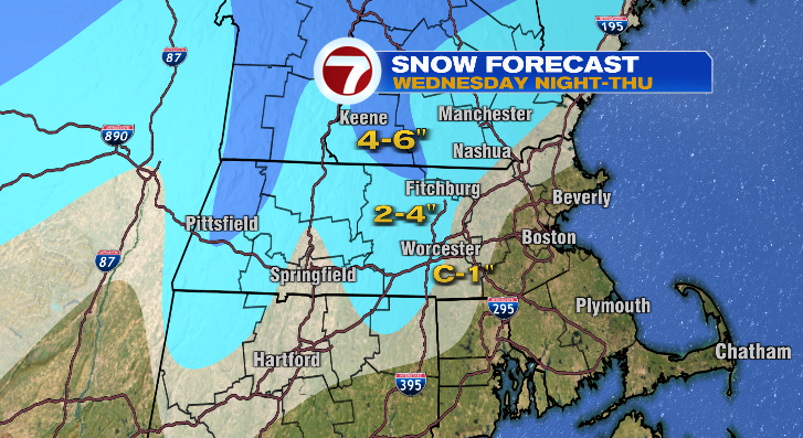
The rain and snow line will meander around the 495 and 95 corridor Wednesday night and into the day on Thursday. Across central Massachusetts, especially the higher elevations, this will be a snow event. Across eastern and southeastern Massachusetts, this will primarily be a rain event.
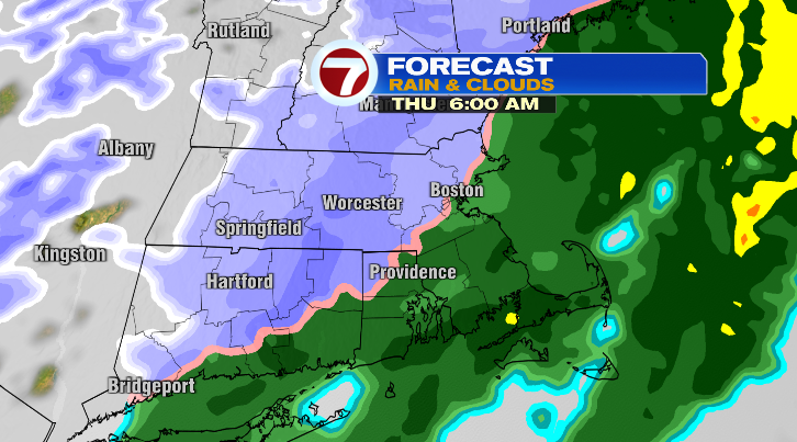
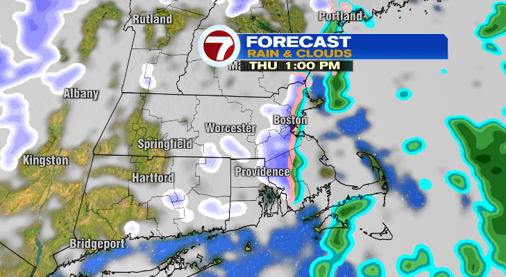
The Thursday morning commute will be a messy one if you’re coming from an area with snow, so plan ahead. While the most widespread snow will continue into Thursday morning, there could still be a couple more rain and snow showers into the afternoon hours as well.
Highs will vary greatly from the 30s inland to the 40s in southeastern Massachusetts. By the time all is said and done, the greatest snowfall totals will be over the Worcester Hills.
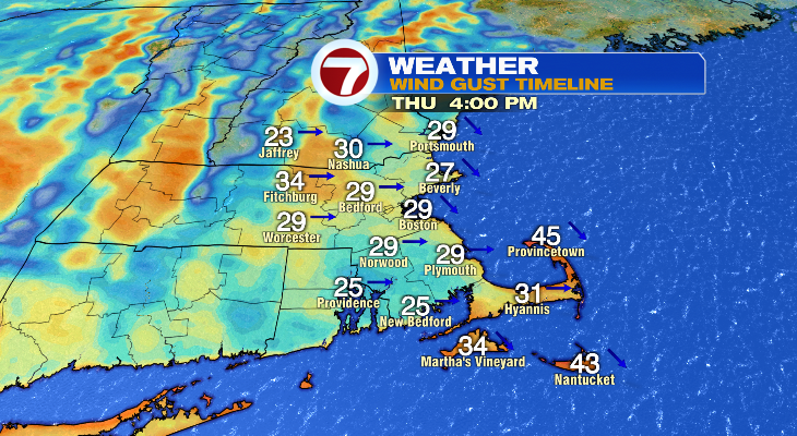
A wind will pick up as the day goes on as well, which will make it feel colder than it really is.
By Thursday evening, most of us will be dry. On the back edge of this storm, get ready for an even bigger cooldown.
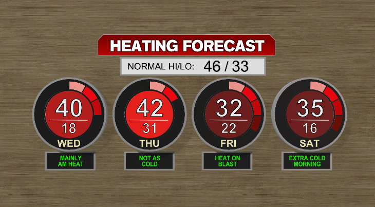
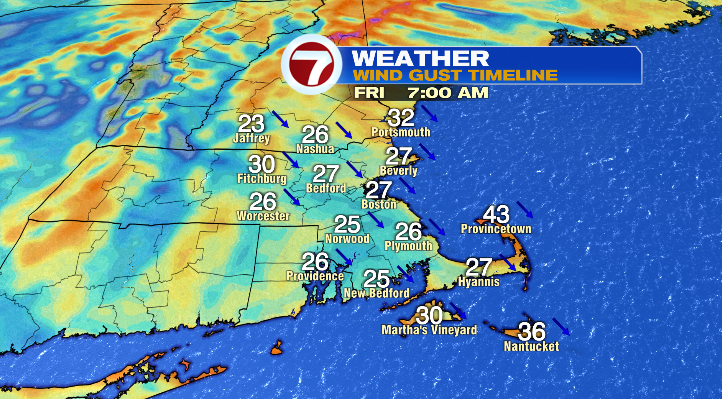
Friday morning will get down to the upper teens and low 20s while afternoon highs will struggle to make it above freezing. The bigger problem will be the wind that will make it feel only like the teens and 20s throughout the day.
Saturday morning will get down to the teens for everyone with highs in the low to mid 30s. It won’t be as windy, but still a chilly…