It’s really feeling like winter this week in Massachusetts. We’ve got snow for some and rain for others before another major temperature drop later this week.
Overnight into Tuesday morning, lows will be bitter-cold again in the upper teens and low 20s. Make sure to bundle up before you head out the door. Skies will be clear overnight. The bright skies continue into the rest of your Tuesday will chilly highs in the mid to upper 30s.
Tuesday night, lows will again drop to the upper teens and low 20s. Wednesday will be dry during the daytime with increasing clouds and highs in the upper 30s and low 40s — it’ll be warmer than that on the Cape. The chance for rain and snow begins Wednesday evening.
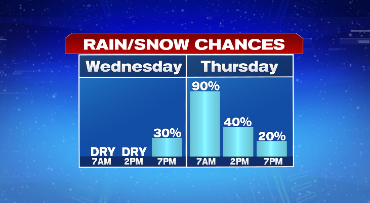
Low temperatures into Thursday morning will tumble into the upper 20s and low 30s. However, across southeastern Massachusetts, lows won’t be quite as cold in the mid to upper 30s. Rain and snow will continue for much of Thursday.

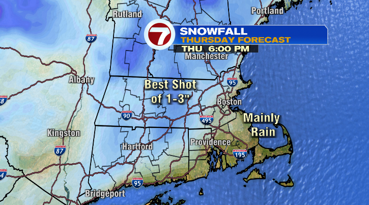
Temperatures will be coldest across the Worcester Hills, which is where the chance for the most snow will be. We could see some light accumulations of wet, heavy snow around 1-3 inches there. Elsewhere, it’ll either be mainly rain or just some scattered coatings. That’s because for many, highs will soar into the 40s on Thursday.
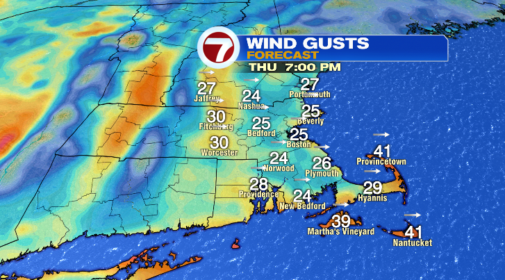
The rain and snow is coming with an Alberta Clipper — a low-pressure system that comes from Alberta, Canada that typically leads to light rain and snow accumulations and some gusty winds. The wind will be a component for us Thursday, mainly later in the day.
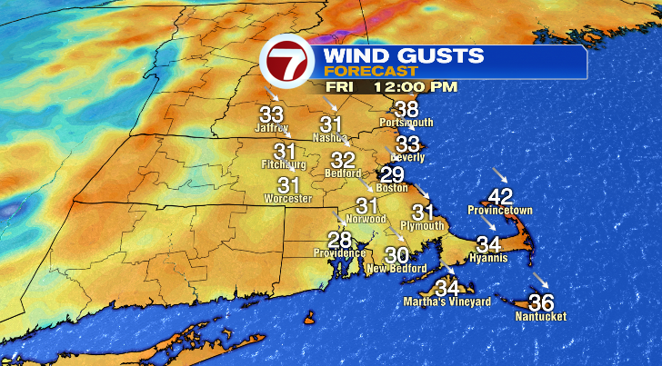
We dry out Thursday night, and on the back edge of this storm we’ll have even colder air in place. Friday, highs won’t make it out of the low to mid 30s for many of us, with highs tumbling into the upper 20s in places like north central Massachusetts. With windy conditions persisting, it’ll feel closer to the 20s during the warmest part of the day.