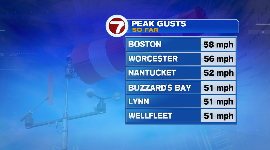
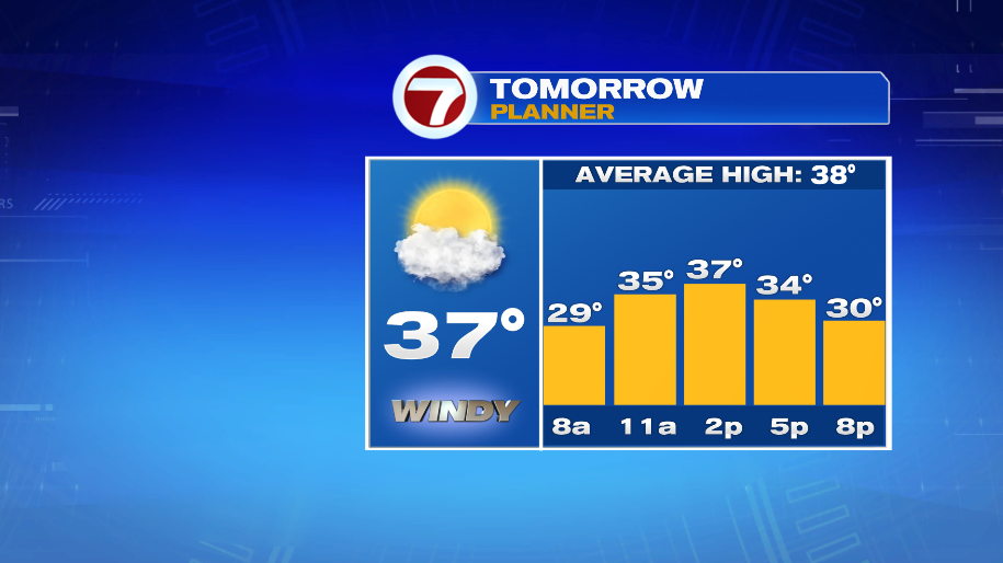
Despite the wind, temperatures fared alright today, climbing to the lower 40s. The problem is, because of the wind, nobody actually felt that warm. Wind chills for the afternoon peaked in the lower 30s. Our typical high temperatures for early January are the upper 30s. The wind is here to stay through the weekend in some form. Thankfully, it won’t be as strong as today. The wind advisory remains in effect until 10pm this evening for wind gusts over 50 mph, which many of us recorded today!
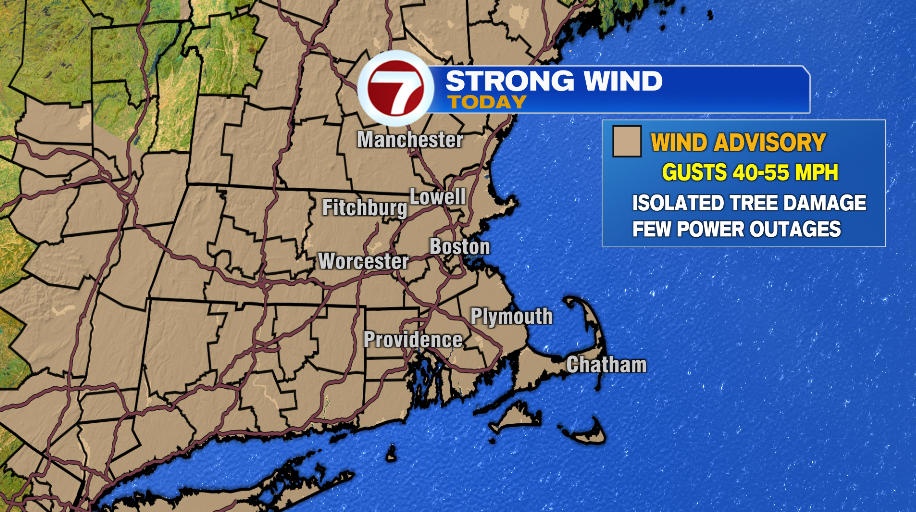
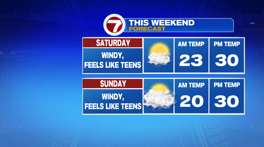
While we won’t stay at the wind advisory level beyond this evening, a cold and gusty wind will be with us all the way through the weekend.
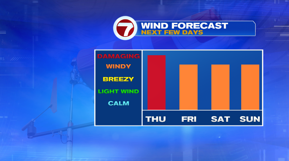
That will take already cold days ahead for Friday, Saturday and Sunday and make them feel even colder. Friday will have temperatures in the 30s, but will feel like the 20s. By the weekend, highs will struggle to make it to 30° but wind chills will remain in the teens both Saturday and Sunday.
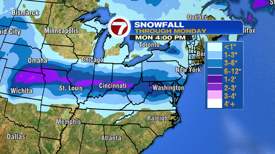
So with the cold air in place, what are the snow prospects? Sadly for snow lovers, they’re not great. The next storm that will have the opportunity to tap into this cold air will stay well to our south. In fact parts of the mid South over to the mid Atlantic are in line for not only a good snow storm, but sadly could bring significant icing to some areas there.
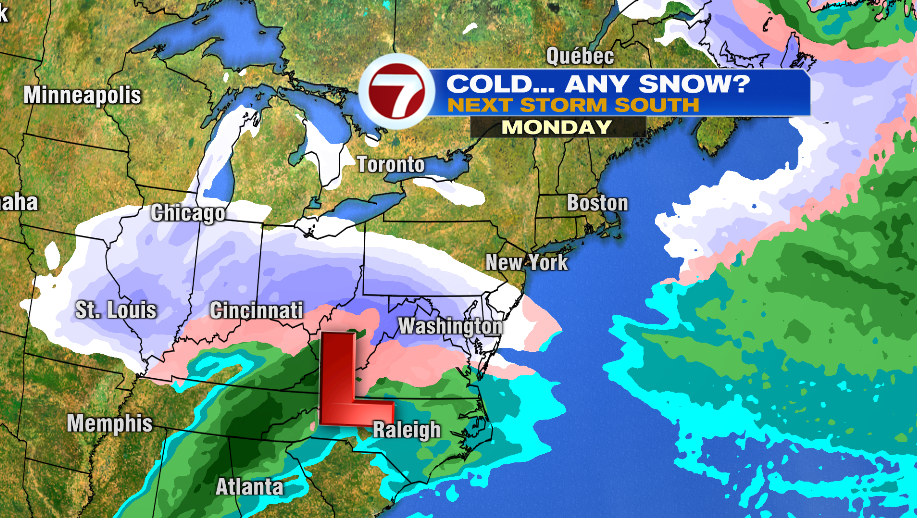
The storm will impact some pretty big cities from St. Louis to Washington D.C. The exact track and temperatures will determine ice vs. snow but obviously more ice means less snow and vice versa. Some towns that can get all or mostly snow could easily exceed a foot of snow, if not even a foot and a half in spots. We’re right on the fringe of this, so the general message is no snow, but it is possible we see some flurries or even a light snow shower Monday evening and Monday night. Of course the most likely areas for this are Southeast Massachusetts and the Cape — areas closer to the storm.